← Back to Portfolio

Station IT Professional

GPS-based surveying and mapping tool for construction professionals

📅 Project Timeline

Started
2016
Status
Completed
Platform
iOS
Industry
Construction

🛠 Tech Stack

Frontend

Swift UIKit MapKit

Backend

PHP MySQL

APIs & Services

CoreLocation GPS Compass

Features

Real-time Tracking Photo Capture Team Sharing

Key Features

Live GPS Tracking

Real-time location tracking with Station Number and Offset calculations updating as you move.

Station Number System

Professional surveying notation showing distance from start point (e.g., 4,567 feet = 45+67.00).

Offset Measurement

Calculates distance from center line with automatic Left/Right detection using GPS and compass.

Point Data Capture

Each point stores: Station Number, Lat/Long, Elevation, Offset, Date/Time, Comments, and Photos.

Project Collaboration

Share projects with team members as Admin or Sub User with different permission levels.

Multiple Map Views

Switch between Satellite, Hybrid, and Standard map views for optimal visibility.

🔄 How It Works

Create Start Point

Place phone at starting location and tap "Create Start Point". Station Number: 0000+00.00, Offset: 000.00

Continue Center Line

Walk along the survey line and create additional center points. Station Number auto-updates based on distance from start.

Create End Point

Walk to the end location and tap "Create End Point". This establishes the center line for offset calculations.

Set Offset Points

Walk to any location off the center line. App calculates Station Number (distance from start) and Offset (distance from line, LT/RT).

Add Photos & Comments

Capture photos and add comments to any point. All data is saved with GPS coordinates and timestamps.

Save & Share Project

Save the project and share with team members. Assign Admin or Sub User permissions.

Start & Center Points
End Point
Offset Points
Current Location

👥 User Roles & Permissions

👑 Admin Users

  • Create, Edit, Delete Projects
  • Create Start, End, Center, Offset Points
  • Edit and Delete any Points
  • Take and Delete Photos
  • Add and Delete Comments
  • Share Projects with Team
  • Manage User Permissions

👤 Sub Users

  • View Shared Projects
  • View All Saved Points
  • View All Photos
  • Add Photos (delete own only)
  • View All Comments
  • Add Comments (delete own only)
  • Create Own Projects (as Admin)
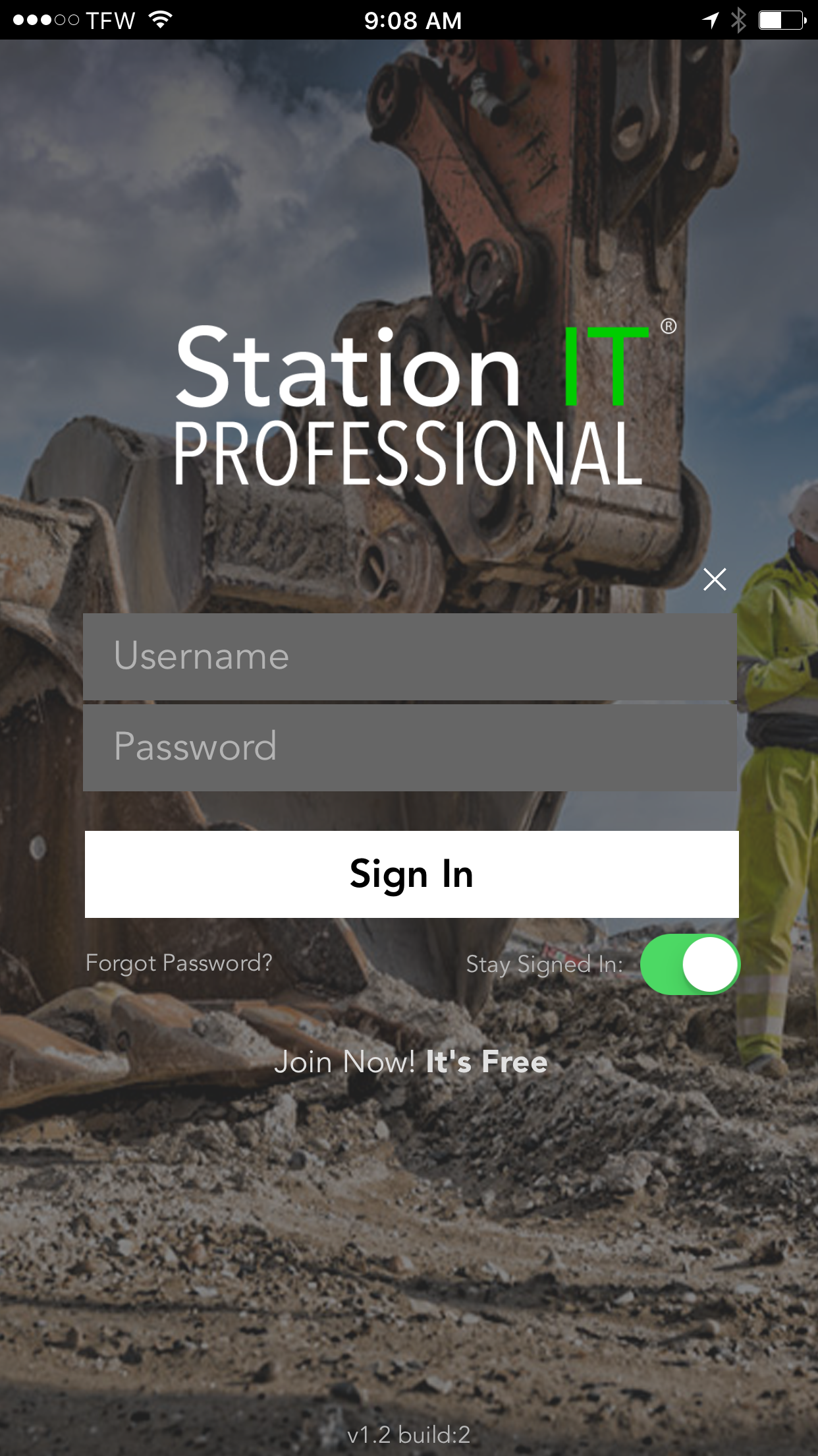
📱 App Screenshots

Scroll within each phone to explore the interface

Login
Login
9:41 📶 🔋

My Profile

⚙️
Username Dustin3938
Password ••••••••••
Confirm ••••••••••
Email Dustin3938@me.com
Phone 111-222-3333
Delete Profile
My Profile
9:41 📶 🔋

My Projects

⚙️
My Projects
Highway 98 - 1
May 25, 2016
Road 46 at Crossing
May 13, 2016
Delete
Deerfield Rd 384
Mar 29, 2016
Invited Projects
Navarre Rd #556
May 25, 2016
Palm Coast #42
May 13, 2016
Create New Project
My Projects
9:41 📶 🔋

Highway 98-1

↗️
Latitude
58.837365
Current
Longitude
-23.757383
Current
Elevation
1159.2
feet
Or Manually Enter:
feet
Lat/Long/Elevation
9:41 📶 🔋

Highway 98-1

↗️
Satellite Hybrid Map
+
Station:
5512
+
22
.
42
Offset:
000
.
00
LT RT
Photos:
📷
Continue Center Line
Create End Point
Continue Center Line
9:41 📶 🔋

Highway 98-1

↗️
Satellite Hybrid Map
+
Station:
5683
+
12
.
37
Offset:
463
.
24
LT RT
Photos:
📷
Set Offset Point
Set Offset Point
9:41 📶 🔋

Highway 98-1

↗️
🧭
End Point
8547+23.02
Center 1
5512+22.42
Start Point
0000+00.00
Station:
8547
+
23
.
02
Offset:
000
.
00
LT RT
Photos:
📷
Create Point
Create End Point
Project Overview
9:41 📶 🔋

Offset 2

Delete
Last Updated: May 25, 2016
Offset 2
Station:3298.43.12
Offset:318.56 RT
Elevation:3837.2
Lat:87.038473
Long:-74.837478
Comments
I set my phone on the "A" block when I took this shot.
Dustin9483 • Sep 8 delete
I noticed a small red flag near the block. Anyone know why?
Gary30384 • Sep 10
Add comments here
Post Comment
Photos:
📷
Offset Point Details
9:41 📶 🔋
Back

Line 2: Center 1

↗️
Last Updated At:
Wed, 7 Jun 2017 @ 2:24:46 PM
Center 1
Station:0001 + 89.44
Offset:000.00 LT
Elevation:1128.00
Lat:40.8990716572
Lng:-81.0983523654
Point Comments
Add point comments here
Post point comment
South tunnel facing
By thomas • Mon, 10 Jul delete
Photos:
📷
Center Point Details
9:41 📶 🔋

Share Project

Highway 98 - 1

Last Edited: May 25, 2016 15:44:00

Share Project with Team
🔍 Search Users by Name or Email Cancel
ADMIN SUB
David9383
MikeEd22
GFRace1
Delete
VicVic554
Share / Update
View Project ›
Share Project